Sponsored

Off-road trail apps for vehicles

camprats

Active Member
First Name
Steve
Joined
Aug 14, 2018
Threads
6
Messages
44
Reaction score
47
Location
Arizona
Vehicle(s)
2018 4-door Rubicon
I was reading some old posts and found that JeepEagle1 asked "Is there an off-road trails app for vehicles? I've them them but most seem to focus on hiking."

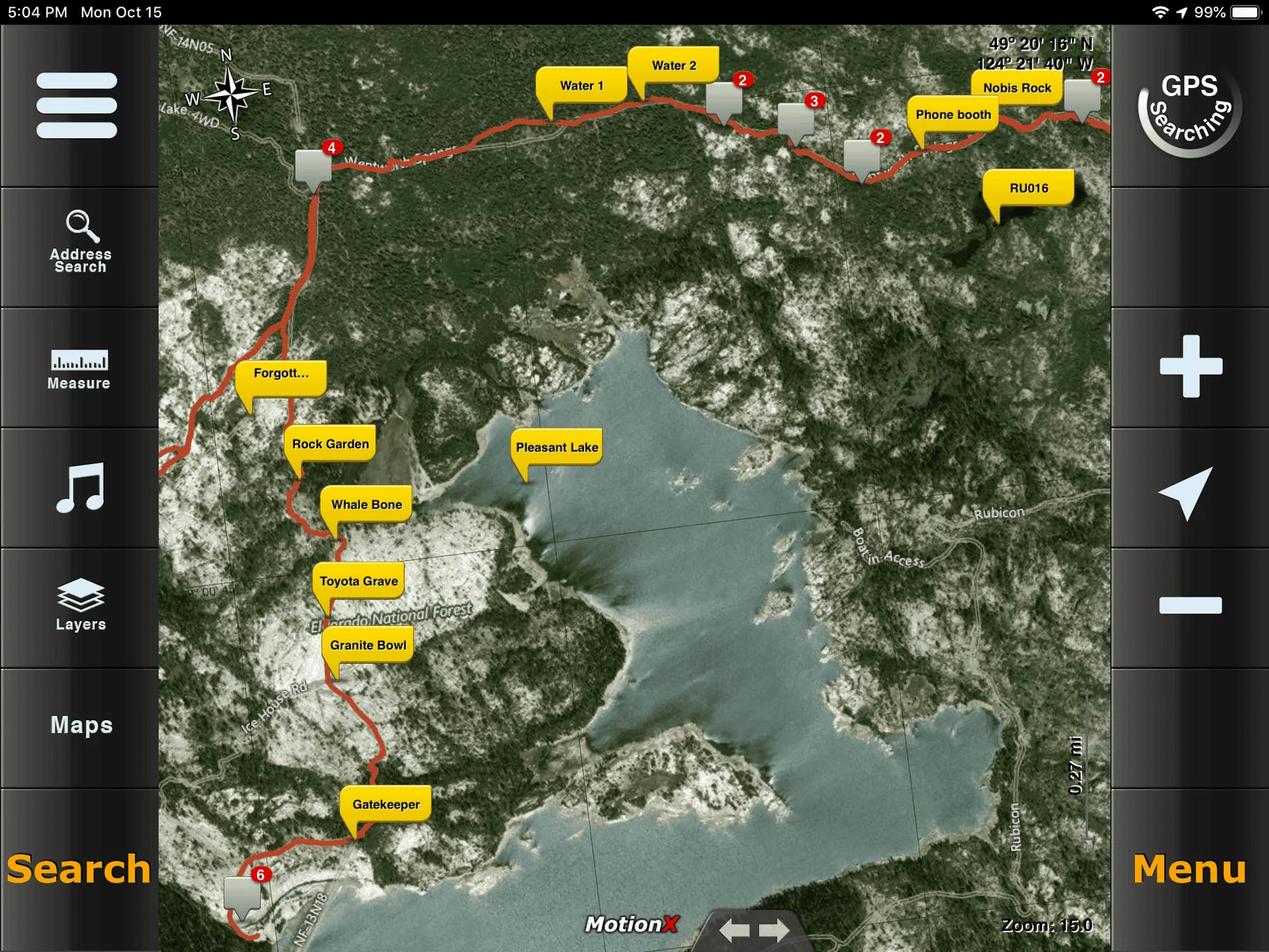
I use 3 different apps on a tablet in my JK (JL coming on Sept 5). These apps will also work on smartphones, but a tablet screen is much bigger. You might try one on a smartphone, then upgrade to a tablet if you like it.

These all work back in the brush where there is no cell service.
Sponsored

 
OP
OP
camprats

camprats

Active Member
First Name
Steve
Joined
Aug 14, 2018
Threads
6
Messages
44
Reaction score
47
Location
Arizona
Vehicle(s)
2018 4-door Rubicon
The question was about apps that could be used in a vehicle, so that is where the link pointed.

You are right that Alltrails is a great web based source of tracks that can be downloaded for use in one of these apps.

JeepTheUSA.com is another source of tracks, and it has a list of yet other websites with tracks.
 

47Jeepster

Well-Known Member
First Name
Tom
Joined
Jul 7, 2018
Threads
23
Messages
621
Reaction score
687
Location
Queen Creek, Arizona
Vehicle(s)
2025 JLUR X ... 2023 JLUR Diesel ... 2018 GC Summit
Occupation
Retired
The Funtreks app is pretty nice.
I use it in Moab.

https://funtreks.com/product-category/mobile-device-apps/
I've got the FunTreks book and their SD card with digital trails ... it was well worth the money. But, it isn't an app! On their website, they recommend Back Country Navigator as an Android to compliment to their digital trails. That's one of the three apps that @camprats recommends on his site.

FunTreks trails are unique in that their digital trails can be read on a Nuvi ... my go-to routing/geocaching aid. Unfortunately, digital trails from other websites (Alltrails, JeeptheUSA, etc.) can't be read by a Nuvi. They work great in a handheld GPS, but the *^%$#^ Nuvi can't read them. FunTreks said they use proprietary software to modify the files so they can be read on Nuvi's, handheld GPS units, smartphones, tablets, or even a computer. But, to read any digital trails on other than a GPS unit, you need an app ...

All three apps that camprats recommends work somewhat similarly. I picked LocusMaps 'cuz it has a geocaching add-on capability. LocusMaps has a steep and bumpy learning curve, but once you figure out the quirks, it works well for off roading. I've been using LocusMaps on an old smartphone with no wireless connectivity for about a month and am now comfortable with it. Am in the process of replacing the battery in my wife's old Nexus 7" tablet to see if I like the bigger screen ... not sure it's a necessary improvement. In Arizona, good off road mapping is a necessity.

Check out camprats recommendations and try one of the apps he discusses. They all have a free version to let you try them out, although their pro versions are cheap ... as in $7.49 for LocusMaps.
 

Sponsored

TroyBoy

Well-Known Member
First Name
Troy
Joined
Jun 14, 2017
Threads
95
Messages
1,413
Reaction score
1,549
Location
Vancouver Island, Canada
Vehicle(s)
2018 JLUR
MotionX GPS but it is iPhone only. They also have an iPad version.
 

Goin2drt

Well-Known Member
Joined
Oct 25, 2017
Threads
48
Messages
2,601
Reaction score
3,247
Location
Kentucky
Vehicle(s)
18 Rubicon, 17 Grand Cherokee Trailhawk
We have found two solutions we are using so far. Trailsoffroad.com to search the routes. Seems to be very intuitive and at least for around here has trails that are not even on these other solutions mentioned in this thread. Then when moving we are using the gaia app. That one seems great so far.

Now I haven’t tried more sophisticated actions like taking from trailsoffroad and downloading to gaia as we have been going with a group and not planning our own. I did however find that once out on the road Gaia is not great for detailing the type of road. For example we wanted to break from the pack, saw there was a road where we wanted to go but had no idea of its status, ability, condition, difficulty etc. literally it was just a black line.
 

5280

Well-Known Member
First Name
John
Joined
Oct 4, 2018
Threads
1
Messages
81
Reaction score
36
Location
Golden, co
Vehicle(s)
JLUR
I have been using Avenza. But always looking for better..
 

TroyBoy

Well-Known Member
First Name
Troy
Joined
Jun 14, 2017
Threads
95
Messages
1,413
Reaction score
1,549
Location
Vancouver Island, Canada
Vehicle(s)
2018 JLUR
Is this App good for Jeep trails as well or just hiking and biking.
It’s excellent. You can download satellite images for the area so you don’t need a connection. You can import/export tracks and waypoints. I have the rubicon trail imported already for my trip next year.
Jeep Wrangler JL Off-road trail apps for vehicles 3863D1E8-9FE6-43AC-A6FA-5F5574A48D9C
 

Sponsored

RubiSc0tt

Well-Known Member
First Name
Scott
Joined
Jun 12, 2018
Threads
64
Messages
1,727
Reaction score
2,355
Location
Upstate NY
Vehicle(s)
2019 JLUR in Punk'n Orange
Build Thread
Link
Occupation
Turn Wrenches/ Write code
Anything for us folks out east? Particularly in NY/New England/ PA? I'm not even looking for maps- I know a handful of trails. I'm more looking to track the trails I do know so I can share them with other trail leaders for my club.
 

TroyBoy

Well-Known Member
First Name
Troy
Joined
Jun 14, 2017
Threads
95
Messages
1,413
Reaction score
1,549
Location
Vancouver Island, Canada
Vehicle(s)
2018 JLUR
Anything for us folks out east? Particularly in NY/New England/ PA? I'm not even looking for maps- I know a handful of trails. I'm more looking to track the trails I do know so I can share them with other trail leaders for my club.
MotionX GPS will work perfect for that but it is iPhone only.
 

47Jeepster

Well-Known Member
First Name
Tom
Joined
Jul 7, 2018
Threads
23
Messages
621
Reaction score
687
Location
Queen Creek, Arizona
Vehicle(s)
2025 JLUR X ... 2023 JLUR Diesel ... 2018 GC Summit
Occupation
Retired
... I know a handful of trails. I'm more looking to track the trails I do know so I can share them with other trail leaders for my club.
There are a ton of options to record and edit trails ... how you do it depends on what you have available.

Recording the track: Here's what I've used 1) handheld Garmin GPS unit 2) Nuvi ... yep, they can't read a .gpx track, but they record them ... go figure. 3) Android phone with LocusMaps installed. The GPS units automatically start recording your track as soon as they are turned on ... very helpful if you're forgetful. LocusMaps has to be told to record your track.

Cleaning up the track: Because I have Garmin GPS units, I use Garmin Basecamp (freeware from Garmin) to clean up/edit the trail. Most times the track includes your trip to the trail and your return trip ... need to end up with only the trail proper. Or you might have traveled the trail in two different segments. Basecamp allows you to combine .gpx tracks and edit them ... delete irrelevant points. Bring up Basecamp on your computer, plug in a Garmin unit, and the track is easily accessible. If you don't have a Garmin unit, but can download the raw .gpx file to your computer, then it is almost as easy to load it into Basecamp for editing.

Other approaches: This won't work in the forested areas like it does in the desert, but ... Bring up Google Earth and use "Add Path" to build a trail. Google earth will save that path in a .klz format. Use "GPS Visualizer" (another freeware program on the internet) to convert the file from a .klz format to the .gpx format to share with your club.

None of the above is complicated or difficult. I capture trails automatically on one of my Garmin units, do some basic editing, and save them as a normal course of events. Last summer I recorded a "short cut" we took to get off the trail we were traveling. Later, when looking at JeeptheUSA's trails in that area, I compared my track to their's and discovered that the short cut was a part of one of their published trails. Now I have a better understanding of the main trails in that area ... and it makes it easy to repeat fun trails that we've taken.
 

OffRoadWarehouse

Well-Known Member
First Name
John
Joined
May 9, 2018
Threads
13
Messages
154
Reaction score
134
Location
San Diego, CA
Website
www.offroadwarehouse.com
Vehicle(s)
2018 Jeep JL
Occupation
Jeep, Shock, Suspension, and Export Specialist
Vehicle Showcase
1
Another to look at is Magellan GPS units. They are standalone units that have Turn-by-Turn navigation on the street, as well as trail information and Lowrance-Style waypoint features.
 

47Jeepster

Well-Known Member
First Name
Tom
Joined
Jul 7, 2018
Threads
23
Messages
621
Reaction score
687
Location
Queen Creek, Arizona
Vehicle(s)
2025 JLUR X ... 2023 JLUR Diesel ... 2018 GC Summit
Occupation
Retired
Another to look at is Magellan GPS units. They are standalone units that have Turn-by-Turn navigation on the street, as well as trail information and Lowrance-Style waypoint features.
I switched over from Magellan to Garmin about ten years ago, so am ignorant as to their functionality today. Are you saying that the auto GPS units will upload and read a .gpx track?
Sponsored


Top