Sponsored

Colorado - Alpine Loop Area - Time to Complete

OP
OP

Cyber_Jeeper

Well-Known Member
Joined
Jan 16, 2022
Threads
5
Messages
179
Reaction score
253
Location
Utah
Vehicle(s)
2022 JLUR
FYI, the full alpine loop (cinnamon and engineer) opened, I believe two days ago. So you have nothing to worry about there. The trails get plowed as the weather allows. Your biggest concern should be Imogene and Black Bear. Imogene was severely damaged by storms last year on the Telluride side, and the San Miguel county road crews said it will be closed until at least September because they have to rebuild the road and a retaining wall to prevent future issues. San Miguel county is THE WORST! Nothing moves fast there when it comes to offroad repairs, so I wouldn't be surprised if the repairs drag into next year. Black Bear was closed all last year only because the county was understaffed and they were continuously working on other roads, like Imogene, due to a lot of severe storms. They never made it a priority to never go clear rock slides on Black Bear. I don't know how this year's Imogene repairs will affect there plans to get on Black Bear. Just have other plans ready in case those are still closed.

I can't speak for how onx uses trail durations, but Trails Offroad uses it one way. So if it's an in-and-out trail, you have to double that time.

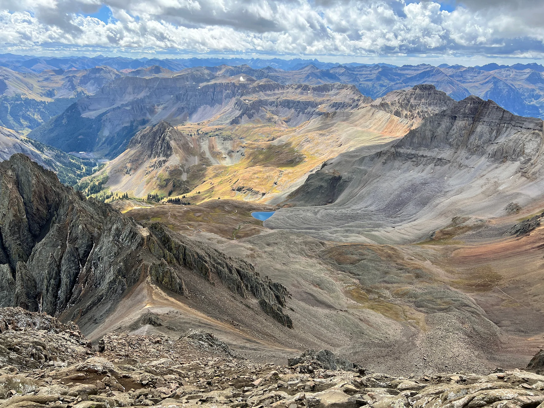
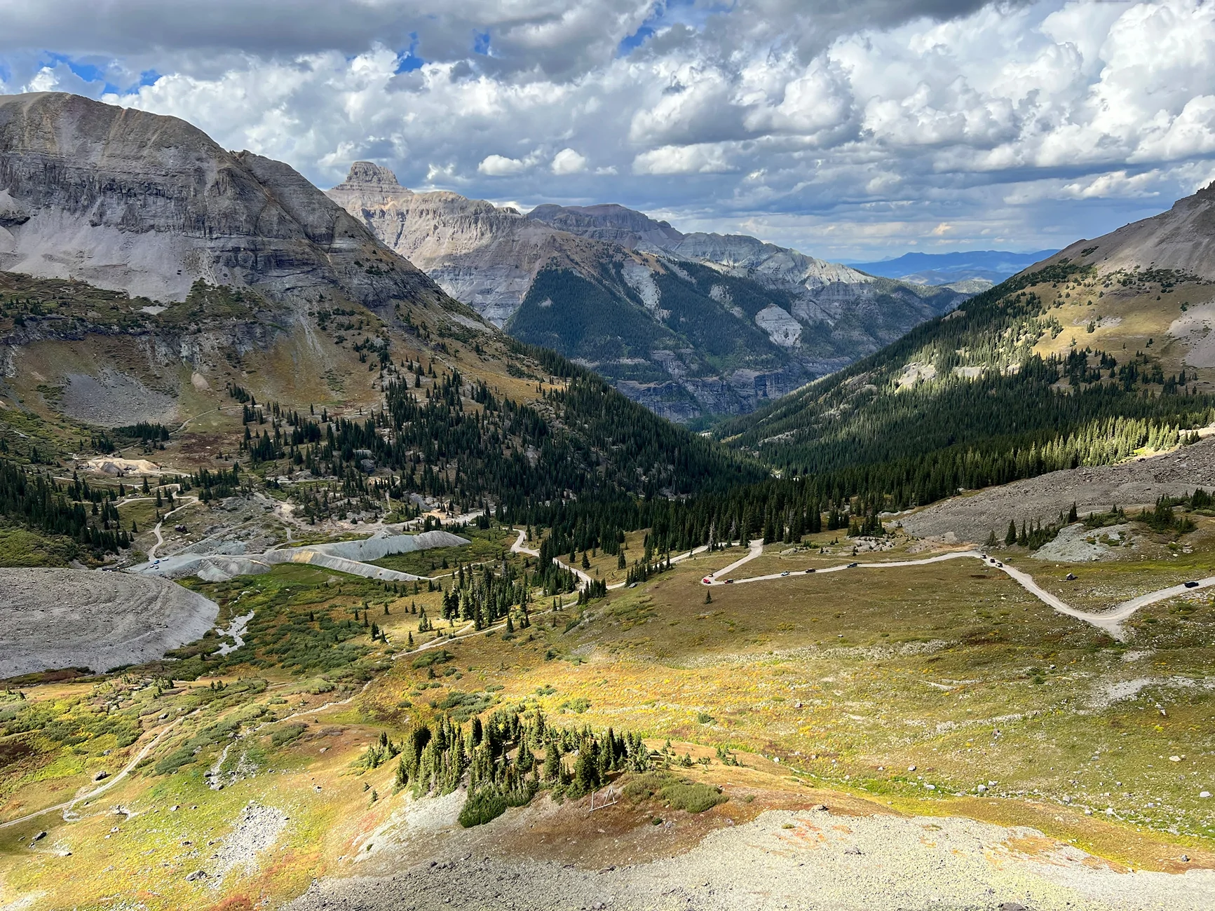
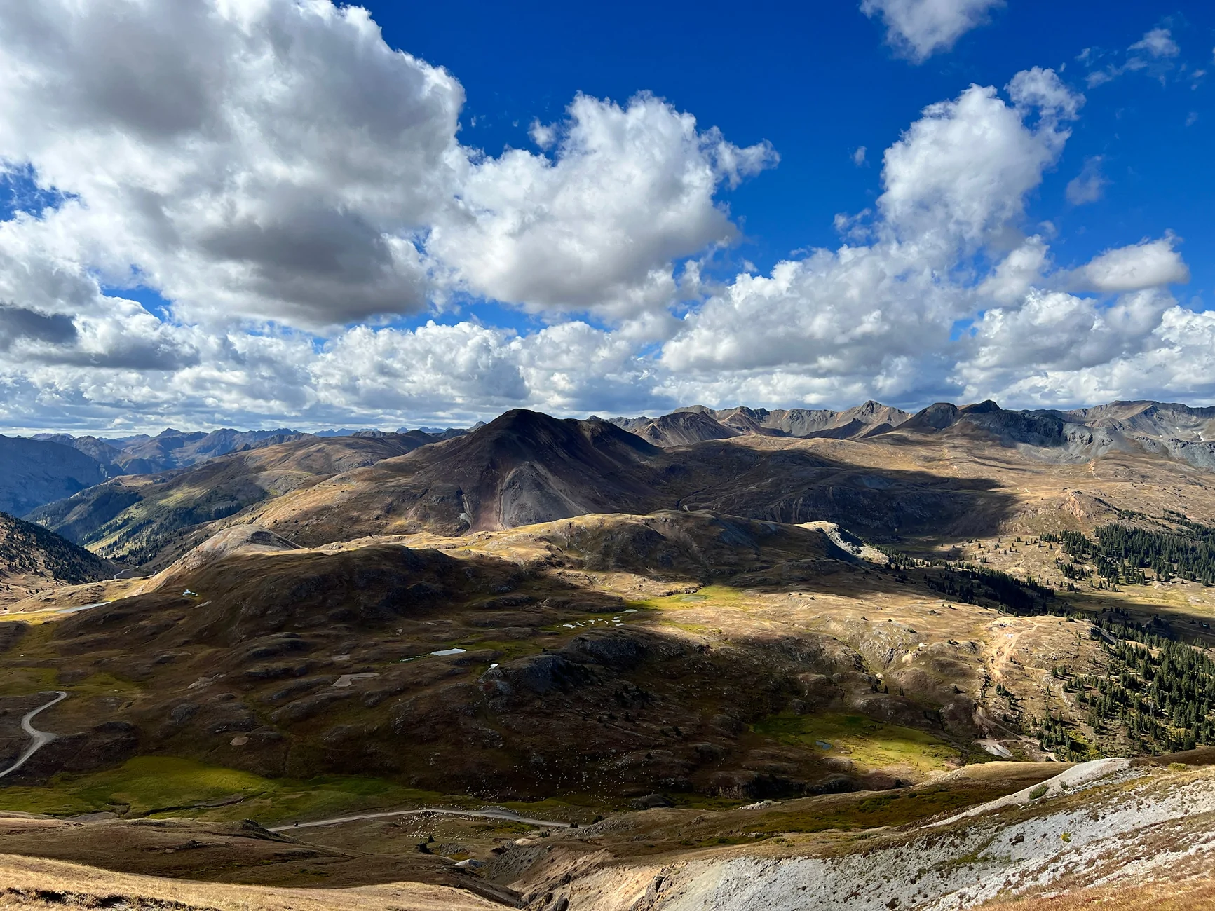
Looking at your last plan of 3 days, the time estimates look pretty good to me for day 1, but short for day 2. Both ends of the loop take about 4hrs each. I move pretty fast as well. I've spent tons of time on those trails and am very comfortable on them. It was my summer vacation spot every year as a young man. You can probably do it in around 3, but you literally would not stop driving, and there is a lot to see... ghost towns, mines, waterfalls, scenic picture spots.
I think California is worth seeing. Way better than CR2. But every trail down there is a little different, but also pretty much the same. They are high altitude, narrow shelf roads with epic mountiain top views and likely mine ruins. You can't go wrong with selecting any, or skipping any, really. You won't be disappointed. But the routes you have, are main routes, so they will be a bit congested, even that time of year, because everyone goes for leaf peeping.
Thanks for that information. Which trail is CR2?

With Imogene probably not being open we will have to change our plans. So I’m thinking something like:

Day 1:
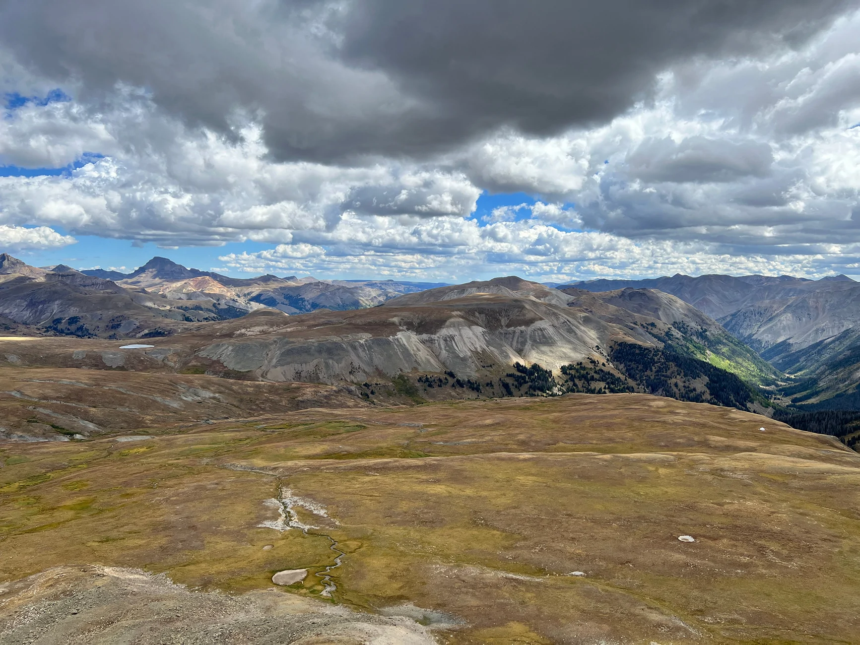
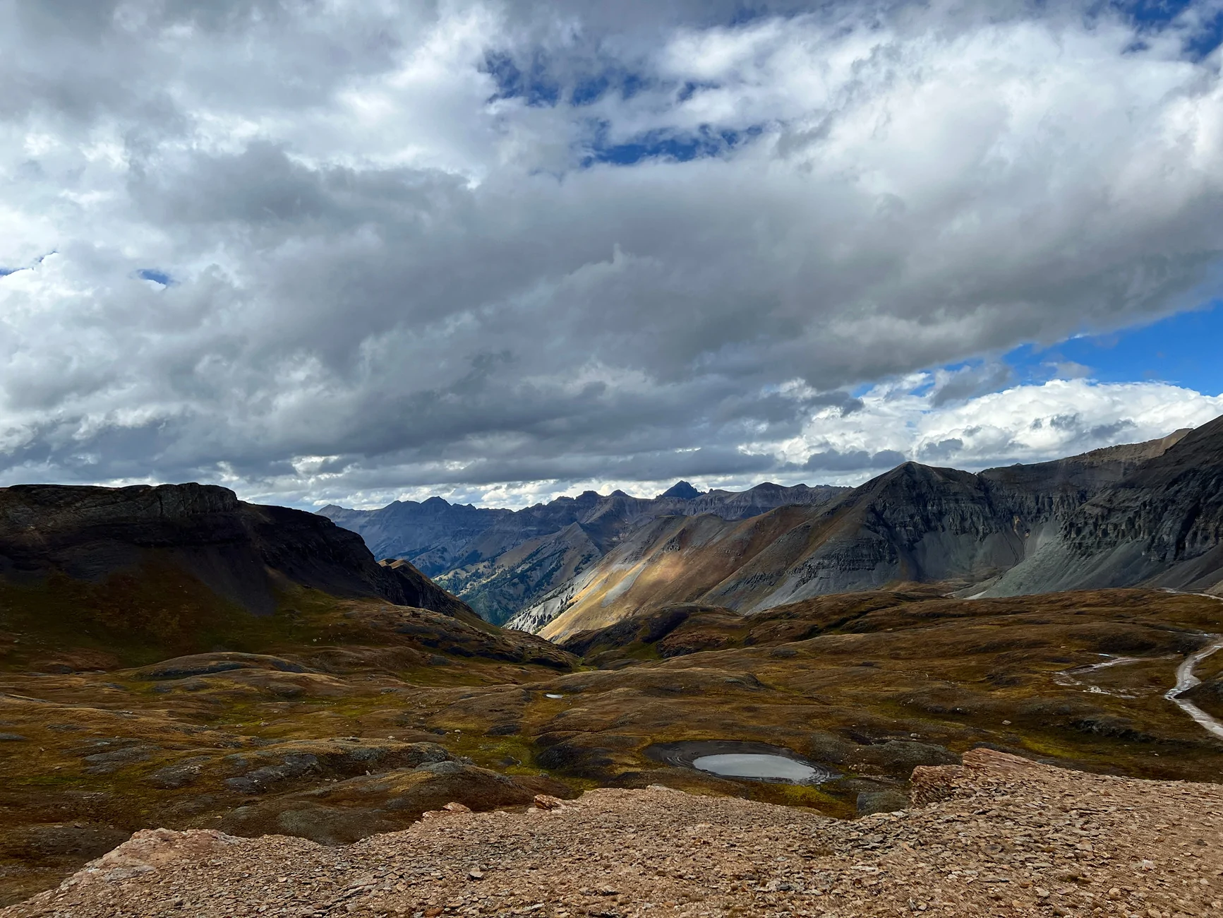
Start in Ouray and drive to the top of Imogene and Yankee boy. Maybe find a good hike in the area too. Camp outside of Ouray.
Day 2:
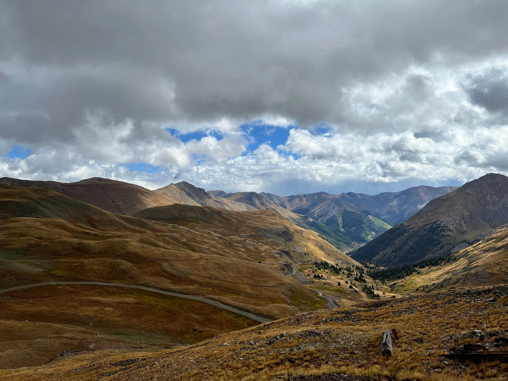
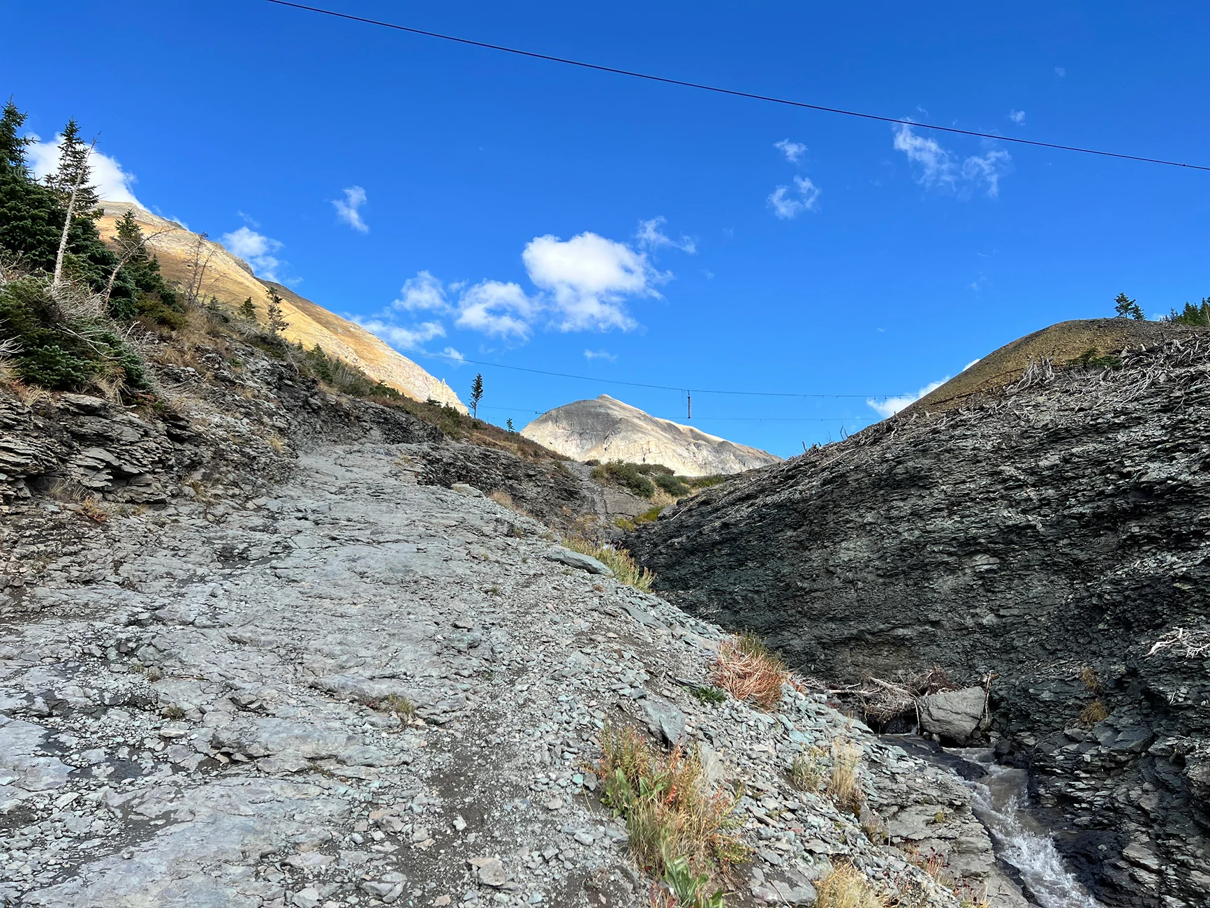
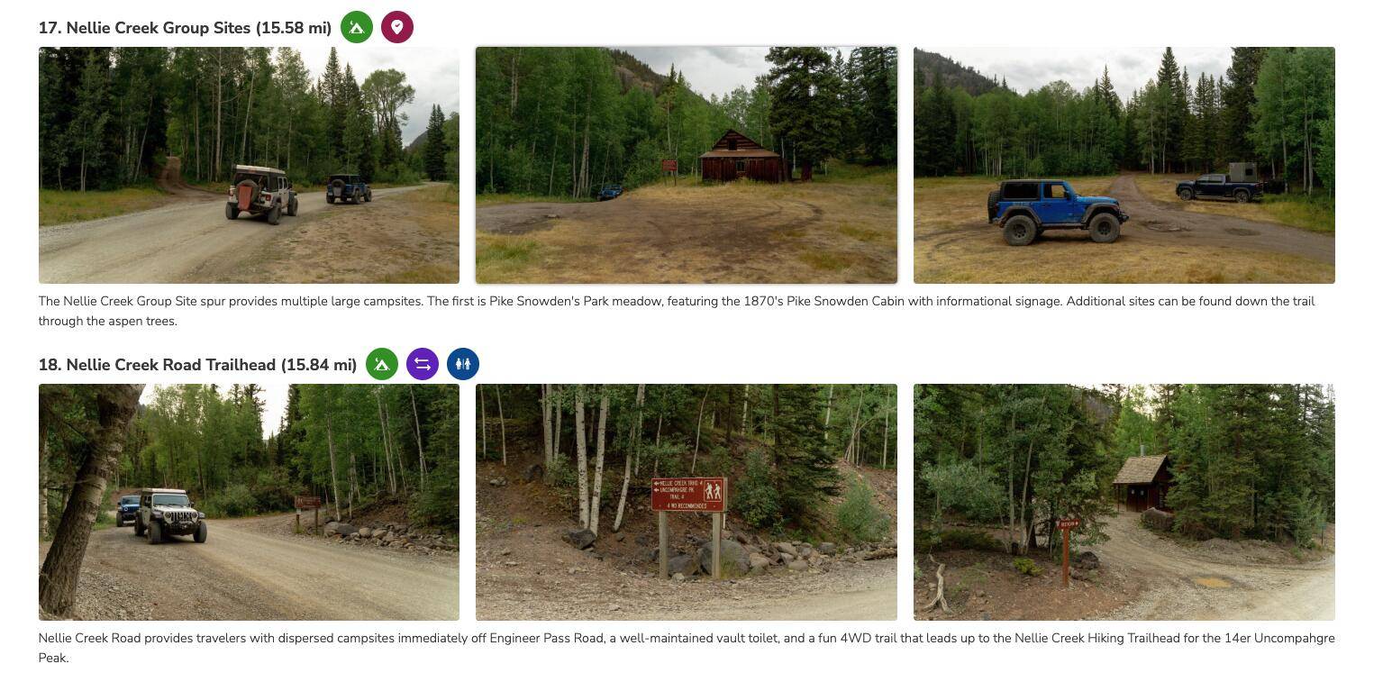
Leave Ouray and do Mineral Creek, Engineer Pass, and then camp partway up Cinnamon Pass. There are some offshoots such as North Henson Creek,Nellie Creek Road, or Wagner Gulch Road to add more time to the day.
Day 3:
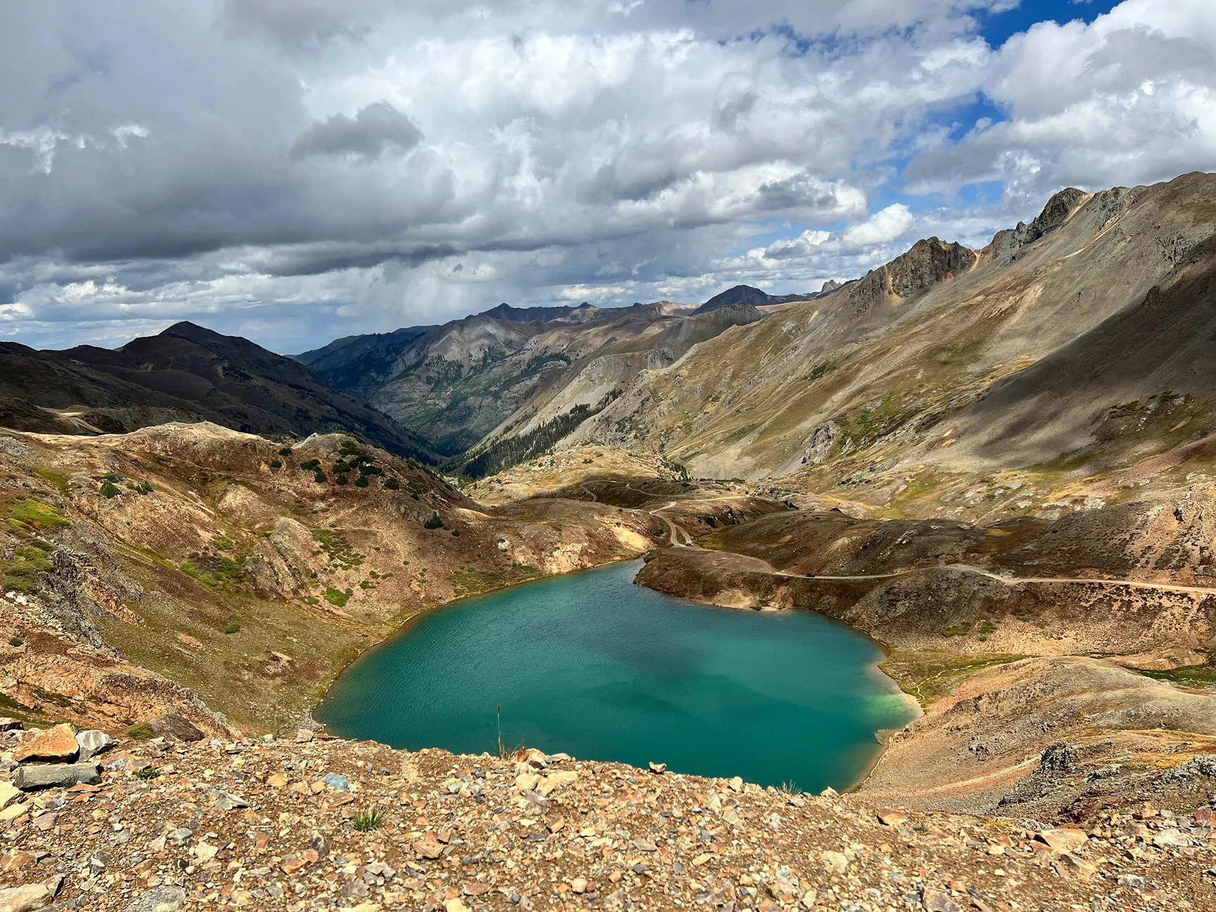
Finish Cinnamon Pass and continue to California Gulch to Silverton to Ophir Pass. Camp outside of Ophir and drive home the next day.

We will probably be out there within September 8th to 14th, not sure of the exact days. But I’m hoping it’s too early for the leaf peepers and I hope to go mid-week to avoid even more crowds. I’m mostly worried about finding camping spots. I’m not familiar with where to boondock and most officialcamp grounds seem to be first come, first serve. I think I will just have to mark a few spots and hope there is an opening.
Sponsored


bd100

Well-Known Member
Joined
Feb 14, 2024
Threads
2
Messages
234
Reaction score
256
Location
USA Midwest
Vehicle(s)
JT
Altitude sickness may ruin any plans. Helps if you stay in the area for a few days before going up high. And a type-A vacation is more exhausting than just going out and seeing what you find, with no agenda and no hurry.
 
OP
OP

Cyber_Jeeper

Well-Known Member
Joined
Jan 16, 2022
Threads
5
Messages
179
Reaction score
253
Location
Utah
Vehicle(s)
2022 JLUR
Altitude sickness may ruin any plans. Helps if you stay in the area for a few days before going up high. And a type-A vacation is more exhausting than just going out and seeing what you find, with no agenda and no hurry.
I got bad altitude sickness years ago hiking Mount Whitney, it’s not fun. While the San Juan’s are higher than the Wasatch here in Utah, my house is over a mile above sea level and I haven’t had any problems hiking to the 10,000-12,000 foot elevation peaks.
Unfortunately this is kind of a guys trip so we are leaving family and jobs behind. I wish I had more time, but it’s just not really feasible. We should be able to stop in Moab on our way over though and see some sights there too.
 

TORRyan

Active Member
Peak Sponsor (Level 2)
First Name
Ryan
Joined
Jul 19, 2024
Threads
4
Messages
28
Reaction score
50
Location
Denver
Vehicle(s)
2023 2DR Wrangler Rubicon
Which trail is CR2?
Some consider this part of Cinnamon Pass. It's the section of road from the town of Silverton to Animas Forks Ghost Town.

camp partway up Cinnamon Pass. There are some offshoots such as North Henson Creek,Nellie Creek Road, or Wagner Gulch Road
Those are off Engineer, just FYI. (Engineer is the north part of the loop, Cinnamon the south side). Engineer offers far more options for dispersed camping. Henson Creek has a lot of awesome sites, and near Nellie Creek road is a great grassy groupsite area called Nellie Creek. Off cinnamon, it is mostly forest service campgrounds, first come first serve. Same with around Ouray. That time of year, if it's mid-week, you likely wouldn't have much issue with finding camping.

Just FYI, in case you want to check it out, Trails Offroad marks specific campsites and shows you pictures of the sites so you can know if it's a spot you want to try and snag.
Jeep Wrangler JL Colorado - Alpine Loop Area - Time to Complete Screenshot 2025-06-03 at 11.54.37 AM


Camp outside of Ophir
Ophir sucks for camping. Small number of limited spots. Instead go up South Mineral which is a little farther south than ophir, just outside Silverton. Tons of camping there. And if you want the ultimate spot, and have time, drive up Clear Lake and camp at the top.
 

MarkInSATX

New Member
Joined
Jun 24, 2025
Threads
0
Messages
2
Reaction score
4
Location
San Antonio
Vehicle(s)
'25JLU/Rubi/6MT/4.88s/35s
First time long time... Been looking forward to doing the Alpine Loop for a while now and hope to get out Sunday or Monday. Starting from Ouray, I figure heading clockwise is the best approach (i.e. taking Engineer from west to east and then back via Cinnamon)? Planning on taking psi down but otherwise trail conditions appear ok? Also feels like a good idea to get an early start.
 

Sponsored

JayJay

Well-Known Member
First Name
Johnny
Joined
Feb 13, 2020
Threads
0
Messages
1,466
Reaction score
4,762
Location
North Georgia
Vehicle(s)
'20 JLR
Starting from Ouray, I figure heading clockwise is the best approach (i.e. taking Engineer from west to east and then back via Cinnamon)?
Going clockwise, in general, keeps the drop-offs to the driver side which I prefer. My wife wouldn't be able to handle the drop-offs being on her side even though the views would be more spectacular. ;)
 
OP
OP

Cyber_Jeeper

Well-Known Member
Joined
Jan 16, 2022
Threads
5
Messages
179
Reaction score
253
Location
Utah
Vehicle(s)
2022 JLUR
FYI, it looks like Imogene pass is now fully open on the Telluride side. We already made plans to stay in the Ouray side so I doubt we will see it.
 

UTAHTRLHNTR

New Member
First Name
David
Joined
Sep 5, 2025
Threads
0
Messages
2
Reaction score
1
Location
Utah
Vehicle(s)
2025 Toyota Tacoma Trailhunter in Bronze Oxide
Newbie here. I'm planning on staying in Telluride September 22-25. I would LOVE to complete black bear pass sometime while I am there. I don't camp, but if there is someone who is taking that route back into Telluride, I would love to meet up. I have no interest in doing that trail alone as I have never been there before. My jeep is quite capable, but I just have a policy to never go out alone, especially on a trail I've never done.
Jeep Wrangler JL Colorado - Alpine Loop Area - Time to Complete 20250412_145812~2
 
OP
OP

Cyber_Jeeper

Well-Known Member
Joined
Jan 16, 2022
Threads
5
Messages
179
Reaction score
253
Location
Utah
Vehicle(s)
2022 JLUR
Now that the trip is over, I figure I should give a bit of a recap.

Day 1
Started in Ouray and traveled up to the top of Yankee boy basin where we hiked to the top of Mount Sneffels. Most of the trail here is easy, with only the last mile or so of Yankee Boy approaching a 3-4 out of 10 in difficulty. We did get rain, hail, and snow on the last couple miles, but it stopped in time for us to hike to the top.

The view from the top of Mount Sneffels
Jeep Wrangler JL Colorado - Alpine Loop Area - Time to Complete IMG_6299


We ate lunch at the small lake at the top of Yankee Boy and then traveled back down. We took the connector that took us onto Imogene trail proper. This little connector was harder than anything else on Imogene. While Imogene has lots of shelf roads, everything felt very wide and safe. Poser Rock was a bit intimidating to drive out onto though because when you drive out you can't see the ground to your left, right, and straight ahead. It's definitely one where you need to trust your spotter.
The view from poser rock.
Jeep Wrangler JL Colorado - Alpine Loop Area - Time to Complete IMG_6336


We went to the top of Imogene, took pictures, and then went back down to Ouray for dinner and hot springs.

Day 2
Day 2 started by taking Mineral Creek to Engineer Pass. Mineral Creek was definitely the hardest section of the whole alpine loop. It was narrower and had more off-camber rock sections than anything else.
Soon after getting above the treeline we were on Engineer Pass proper. This was a very pretty drive to the top. At the top we did a small hike to Darley Mountain, where we again got rained on.
Most of the way up Engineer Pass
Jeep Wrangler JL Colorado - Alpine Loop Area - Time to Complete IMG_6367


The top of Darley Mountain, looking down Engineer pass towards Lake City.
Jeep Wrangler JL Colorado - Alpine Loop Area - Time to Complete IMG_6395


The top half of Engineer pass down to Lake City was bumpy, but easy. The second half was something you could do in a sedan.
We ate lunch part way down the backside of Engineer.
Dinner and lodging was in Lake City.

Day 3
The final day had us travel up Cinnamon pass. Most of this was very easy, we even had time for a detour up American Basin. (Again, in a thunderstorm).
The top of Cinnamon Pass.
Jeep Wrangler JL Colorado - Alpine Loop Area - Time to Complete IMG_6430


From here we explored the old mining towns and went to the top of California Gulch. The top of California is also basically the top of Poughkeepsie Gulch, but we continued west and south to CR10 and CR110 until we got to Silverton.
Looking at Lake Como, towards Poughkeepsie Gulch.
Jeep Wrangler JL Colorado - Alpine Loop Area - Time to Complete IMG_6441


We ate lunch in Silverton and explored the historical sites.
At this point we decided that nothing we did seemed sketchy or scary, so we decided to take Black Bear Pass back to Telluride.
While the rest of the trails had shelf roads, everything felt very wide. You could steer 4 feet in any direction and be fine. Mineral Creek was the narrowest, but the off-camber and narrow sections are in the trees so there was little risk of falling far down the hill side.
Black Bear was narrow and off camber with lots of exposure. It was a big step up from everything else. I didn't find the final steps feature that scary, I think because there was really only one line choice. There are two waterfall sections before that offered multiple line choices, which was difficult because it was our first time and we didn't know which line was best. Those two features were the only time on the whole trip we had to get out and walk it before attempting it for real. Those features in particular were also very off camber (20 degrees or so) and are steeper in real life than the pictures show. Other parts above and especially below are just way more narrow than anything else on the Alpine Loop. You may only have 8 inches of dirt before your wheels start hanging off the edge, but if feels like much less in the driver's seat. The switchbacks weren't bad. They were tight, but even in a 4 door they weren't scary or difficult. It did storm right as we started the trail, so the bit of rain and mud didn't help inspire confidence.
The top of Black Bear Pass was very pretty and you don't see it much in other pictures. Even if you don't want to do the full trail, getting to this point is fairly easy and very scenic. And it's two way up until this point.
Jeep Wrangler JL Colorado - Alpine Loop Area - Time to Complete IMG_6450


Looking back up the infamous steps.
Jeep Wrangler JL Colorado - Alpine Loop Area - Time to Complete IMG_6457


At this point even more rain (and possibly snow) was coming our way that night and in the morning. We decided that instead of camping near by we would drive a couple hours west until we got away from the mountains. We were able to escape the overnight rain and camped 45 minutes from Moab.

Day 4
This was mostly a travel day back to SLC, UT, but we did stop in Moab. I had never done Hells Revenge so we gave it a shot. We skipped the higher risk features like Hells Gate but still ran into excitement in the end. We got stuck in a thunderstorm the last 10 minutes of Hells Revenge. There is nothing like being on a 20 degree off-camber slickrock in pouring rain, but we made it out just fine. Other than getting wet airing up the tires.


Overall I felt like our timing worked out well. If you skip the hikes and optional canyons like Yankee Boy or Black Bear I could see it being possible to do the whole thing in one day. But 3 days with the hikes and plenty of photo stops made for a relaxing trip.
While we did run into people on the trails, I wouldn't consider it crowded. We had a bit of trouble finding a campsite the first night, but the rest was fine too.
If you are thinking of doing the loop but haven't yet, do it!
Sponsored


Top